Sarchapet (Sarch’apet)
Sarchapet (Սարչապետ), is a village in the Lori Province of Armenia, near the border with Georgia.
Sarchapet Population 2100. Territory- 23.9 km2 The community was established in the 1820s and 1830s. Inhabitants mainly are migrants from Mush and Alashkert, Western Armenia, who migrated during Russian−Persian war in 1826-28 and moved to Eastern Armenia. Such a group came near the mountain Lokh, as it is told, to pass the woods. It is told that the wheel of the coach was broken and the family settled at the foot of the second queen Lokh (after Lalvar), and in the northern part it is bordered by Georgia. It is worth of importance the name of the village. There is no explanation for it. Near the village benefition is being built a church. There is church which is closed (1913). The relief is mountainous, erosion is seen here; summers are mild, winters- cold. Winter lasts for 202 days, summers- 163. Average temperature is 3.6oC, and the highest-+28 o C -30 o C. Annual precipitations are from 700 to 720 mm. The lands are on 30-40ï‚° inclination. Fruitfulness is low because of bad geographical position and unfavorable weather. Height from sea level is 1705m. Distance from the regional centre is 70 km, from the previous district centre- 15 km. The community is mainly specialized in growing of potato, wheat and barley. This production depends on the caprices of the nature. It is still possible to gather some harvest in rainy years, but in drought years villagers lose 75% of the harvest. Those who are occupied with cattle-breeding, produce milk and meat. The village has a secondary school. The community had a church built in 1913, which is semi-destroyed now. The new church of the community is semi-built, the beneficiary of which is a businessman from Sarchapet, who lives in Russian Federation. There is a chapel on the northern part of the village on the mountain Lokh, where is celebrated the holiday of Hambardzum.
* World Gazeteer: Armenia – World-Gazetteer.com
* World Gazeteer: Armenia – World-Gazetteer.com
Map - Sarchapet (Sarch’apet)
Map
Country - Armenia
 |
 |
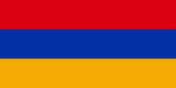
| Flag of Armenia | |
Armenia is a unitary, multi-party, democratic nation-state with an ancient cultural heritage. The first Armenian state of Urartu was established in 860 BC, and by the 6th century BC it was replaced by the Satrapy of Armenia. The Kingdom of Armenia reached its height under Tigranes the Great in the 1st century BC and in the year 301 became the first state in the world to adopt Christianity as its official religion. The ancient Armenian kingdom was split between the Byzantine and Sasanian Empires around the early 5th century. Under the Bagratuni dynasty, the Bagratid Kingdom of Armenia was restored in the 9th century. Declining due to the wars against the Byzantines, the kingdom fell in 1045 and Armenia was soon after invaded by the Seljuk Turks. An Armenian principality and later a kingdom Cilician Armenia was located on the coast of the Mediterranean Sea between the 11th and 14th centuries.
Currency / Language
| ISO | Currency | Symbol | Significant figures |
|---|---|---|---|
| AMD | Armenian dram | Ö | 2 |
| ISO | Language |
|---|---|
| HY | Armenian language |


